

ADCIRC Prediction System™ Input to DOT
ADCIRC is a system of computer programs for solving time dependent, free surface circulation and transport problems in two and three dimensions. These programs utilize the finite element method in space allowing the use of highly flexible, unstructured grids. Typical ADCIRC applications have included:
- prediction of storm surge and flooding
- modeling tides and wind driven circulation
- larval transport studies
- near shore marine operations
- dredging feasibility and material disposal studies
Related products include:
- ADCIRC v56- Updates to ADCIRC code including new channel algorithm
- APS/Floodwater – Release of ecFlow based job management system for APS
- adcircprediction.org website with access to the APSViz webportal
- Situational awareness briefings – Daily coastal flooding situational awareness briefing during hurricanes that impact the US East and Gulf coasts distributed via the US DHS
- Data products provided to NC DOT for ingest into T-SAPP and BridgeWatch decision support systems
NC DOT Uses APS™ Products in Decision Support System
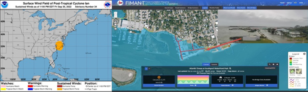
Every year since its inception, the CRC has provided real-time coastal water level and wave conditions prior to severe coastal storms for decision support. During the current reporting period, daily briefings were provided to DHS, the US Coast Guard, and other requesting agencies. Briefings included the latest National Hurricane Center forecast advisory, a narrative summary of APS forecasts, and detailed maps, graphs, and charts that summarized maximum water levels and water level time series locations for the most likely storm track scenarios within the cone of uncertainty. After many years of development funding from the CNHR, the CERA group (https://cera.coastalrisks.live) spun off their coastal hazard forecasting and display capabilities and are now self-supported. Customized data products from APS forecasts are now being ingested into the North Carolina Department of Transportation’s T-SAPP, FIMAN-T and BridgeWatch decision support systems to provide enhanced situational awareness in advance of major storms affecting the NC coast. An example of APS results displayed in the FIMAN-T system is shown in the figure below for Hurricane Ian (2022) as it approached the Carolina coast.
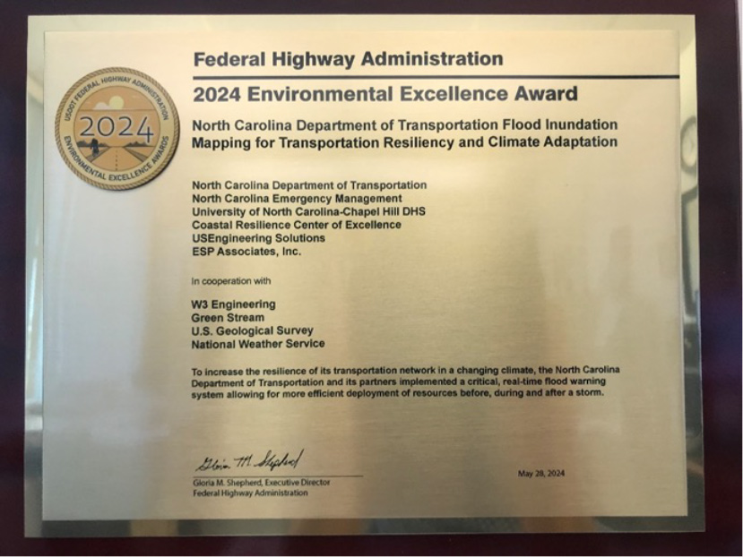
In recognition of the use of APS with the NC DOT’s decision support systems, the state, CNHR/CRC, and the private sector company who created the decision support software were awarded the 2024 Environmental Excellence Award by the US Federal Highway Administration (below). This success has spawned joint CNHR – NC DOT and CNHR – SC DOT proposals to the Federal Highway Administration to expand this capability in both North Carolina and South Carolina.
Research Participants & Partners
Developed through the research projects ADCIRC Prediction System (APS)™ Enhancements and Coordination. Rick Luettich (University of North Carolina at Chapel Hill) and APSViz: Creating Data Products from the ADCIRC Prediction System™. Brian Blanton (RENCI, University of North Carolina at Chapel Hill).