
University Network Study
Building Resilient Infrastructure and Communities (BRIC)
Developed through the research project, A Multi-decadal Coastal Water Level Model Reanalysis for Coastal Inundation and Flood Risk Assessment, Brian Blanton, Rick Luettich (University of North Carolina at Chapel Hill).
Related products include:
- Versions 0.9 and 1.1 of the CORA database which is publicly available from https://tidesandcurrents.noaa.gov/cora.html
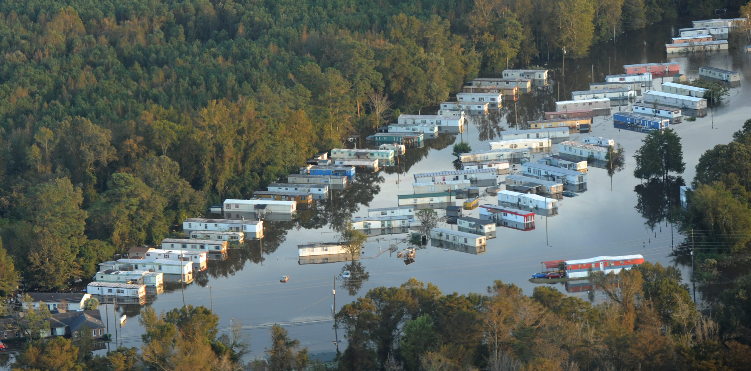
Creation of the Coastal Ocean and ReAnalysis (CORA) database was conceived and initially proposed to NOAA by CNHR director Rick Luettich. The resulting project has been executed by PI Brian Blanton and his team at RENCI together with Luettich and other partners and contractors at NOAA’s National Ocean Service. The dataset delivers 43 years of historical water level and wave information every 250-500 meters along the U.S. Gulf and Atlantic coasts. CORA was officially released by NOAA’s Center for Operational Oceanographic Products and Services in January 2025, to provide a more complete picture of how water levels and flood frequencies have changed over time between NOAA tide gauges, where historical observations are not available. Users from the scientific and research communities will be able to use this dataset to help advance research, machine-learning, and policymaking in a variety of sectors, such as coastal resource management and energy planning.
NOAA is now integrating this dataset into its existing products, including the Sea Level Calculator and High Tide Flooding Outlooks. Once complete, city planners, engineers, flood management professionals and state/local decision makers will be able to support their coastal flood planning efforts with more accessible historical information.
This dataset also provides the building blocks for NOAA to deliver coastal flooding predictions in those same locations between NOAA tide gauges, where predictions are not currently available. CORA significantly expands NOAA’s capacity to provide more communities with timely information about their flood risks so they can mitigate potential impacts.
Depending on appropriations, future efforts are planned for the U.S. West Coast, Hawaii, Alaska, and the Pacific Islands. The CORA Gulf, Atlantic, and Caribbean data can be accessed through the NOAA Tides and Currents website, alongside maps, use cases, and related resources that are currently under development.
NOAA named CORA as one of its top 10 innovations for 2024.